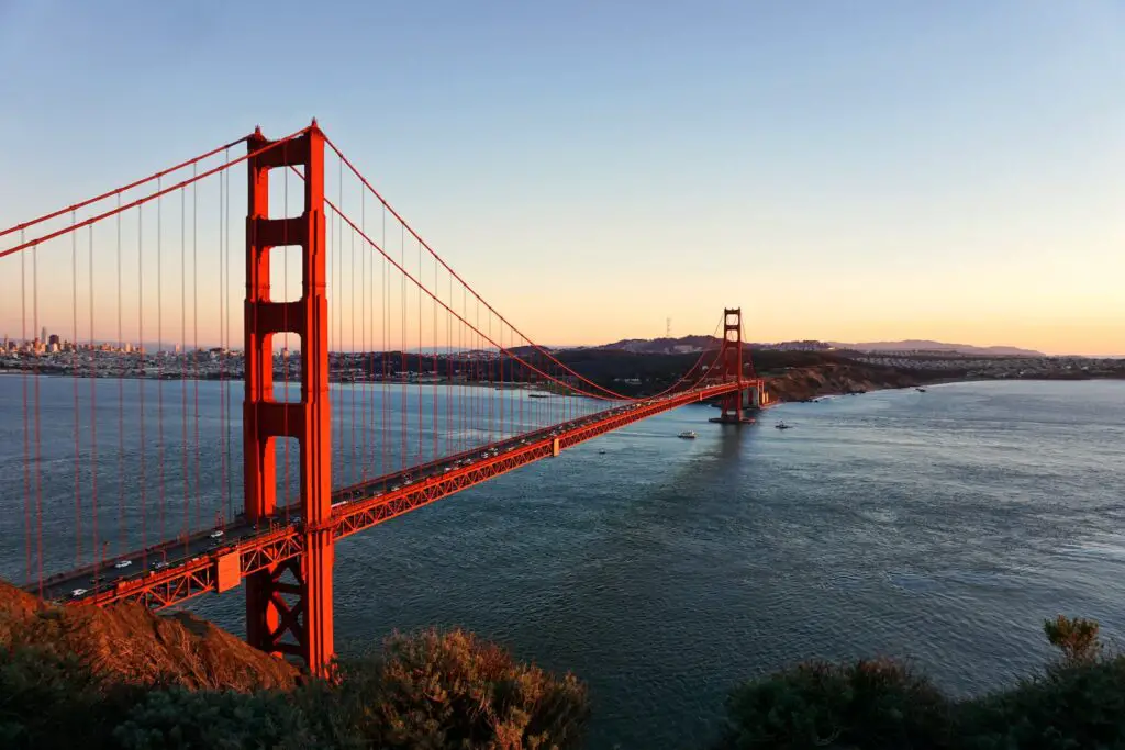
San Francisco, located in Northern California, is a diverse city serving as a major cultural and economic hub, drawing tourists and businesspeople alike.
This city has unique features such as bustling arts and music scene, diverse neighbourhoods, and stunning natural splendour.
San Francisco has long been a leader in environmental sustainability, taking numerous initiatives to reduce its carbon footprint and promote renewable energy sources.
Though San Francisco is unlikely to become submerged anytime soon, its surrounding area and city are vulnerable to flooding due to rising sea levels caused by climate change.
If sea levels continue their current path, low-lying areas and coastlines may experience more flooding, severely affecting local communities and infrastructure.
What Will Be The Effects Of Climate Change On San Francisco?
San Francisco and the Bay Area have long been known for their mild climate and signature fog, but rising ocean levels due to global warming threatens this characteristic feature that has defined this region’s identity.
Fog is essential in maintaining the Bay Area’s climate, keeping temperatures stable and providing moisture to the region.
However, California’s intense fog could also solve its severe drought problems. Capturing moisture from fog could be an untapped resource to help alleviate California’s water scarcity issues.
Thus, it is paramount to safeguard this unique weather pattern and explore its potential advantages.
What Are The Possible Effects Of A Tsunami On San Francisco?
A potential Tsunami wave in San Francisco Bay could devastate different parts of the city.
The surge could spread into the bay and cause extensive flooding in places like Crissy Field, Mission Bay, and Marina.
However, as the wave travels towards Treasure Island or East Bay, its height could reduce significantly – likely reaching less than three feet high.
Therefore, this wave is unlikely even to make it to South Bay.
Although a potential wave could cause damage in some parts of the city, its overall effect would be limited.
Nonetheless, staying alert and taking necessary measures to safeguard vulnerable areas during natural disasters is essential.
How Was San Francisco Built On Water?
Artificial fill refers to the land created by human activity, such as piling up the soil, rocks, rubble and mud.
In San Francisco Bay, much of this artificial fill was produced by pumping mud from below the bay’s surface and using it to fill piles of stones that would then dry out.
This method allowed for the creation of new land in underwater areas.
However, it had significant environmental repercussions, such as altering water flow patterns and disrupting local ecosystems.
Furthermore, using the artificial fill can increase the likelihood of subsidence – which could cause the land to sink over time.
Therefore, assessing artificial fill potential impacts carefully and utilising sustainable practices when creating new land is essential.
Is There A Possibility Of San Francisco Experiencing Flooding?
San Francisco faces a moderate risk of flooding over the next three decades due to rising sea levels caused by climate change.
Low-lying areas and the coastline are particularly vulnerable, placing San Francisco along the shore at greater risk.
Flood risk levels are determined by land elevation above sea level, proximity to the coastline, and topography surrounding an area; some regions are more prone than others.
This risk could be further increased if inadequate protection against flooding is inadequately provided.
Flooding has devastating effects on property damage, financial losses, public health hazards and disruptions to daily activities.
Communities must take necessary precautions to reduce these hazards while adapting to changing climate conditions.
What Is The Average Depth Of The Water In San Francisco?
The San Francisco Bay is an extensive body of water that covers over 1,600 square miles along the California coast.
The average depth of the bay is approximately 12-15 feet, making it relatively shallow compared to other large bodies of water.
However, in some areas of the bay, such as the region between Hayward and San Mateo to San Jose, the average depth can be as shallow as 12 to 36 inches.
This shallow depth can pose challenges for navigation and shipping in the area and increase the risk of flooding during extreme weather events.
Moreover, the shallowness of the bay also makes it more susceptible to environmental changes, such as temperature fluctuations, pollution, and sedimentation.
Why Is San Francisco Cooler Than The Rest Of The Bay Area?
San Francisco cool climate can be attributed to its unique geography.
Situated on a peninsula, San Francisco city is encased by cold water where the Pacific Ocean and bay meet, creating a fog that helps regulate temperatures – commonly called “natural air-conditioning”.
Furthermore, due to its location, strong ocean winds often blow in from outside, further contributing to this chill climate in San Francisco.
Despite these challenges, San Francisco remains one of the world’s beloved cities due to its iconic geography and climate.
How Is San Francisco Being Affected By Sea Level Rise?
According to climate scientists at UCLA and UC Berkeley, more than 900 hazardous sites could be inundated with ocean water or groundwater by the end of this century.
These sites include power plants, sewage treatment plants, refineries and other facilities – placing San Francisco and the entire Bay Area at risk.
Furthermore, rising sea levels could cause coastal erosion, flooding and saltwater intrusion into freshwater sources.
The Bay Area is particularly vulnerable to these effects due to its geography and proximity to the ocean.
Climate change is melting polar ice caps, leading to increased sea levels; if immediate action is not taken to reduce carbon emissions and slow down climate change’s progress, these problems are only expected to worsen.
What Is The Abandoned Area In San Francisco?
Drawbridge, an underwater city in San Francisco Bay Area, was abandoned in 1979 when its last resident moved out.
Since then, it has sunk into the marshes and become a haven for birdwatchers and other wildlife admirers.
However, due to safety concerns, no trespassing is allowed, and now forms part of Don Edwards San Francisco Bay National Wildlife Refuge.
With its fascinating history and hauntingly abandoned buildings, Drawbridge is an intriguing destination.


